Yellow Alert Weather: Thunder on Wednesday morning and strong winds in the afternoon
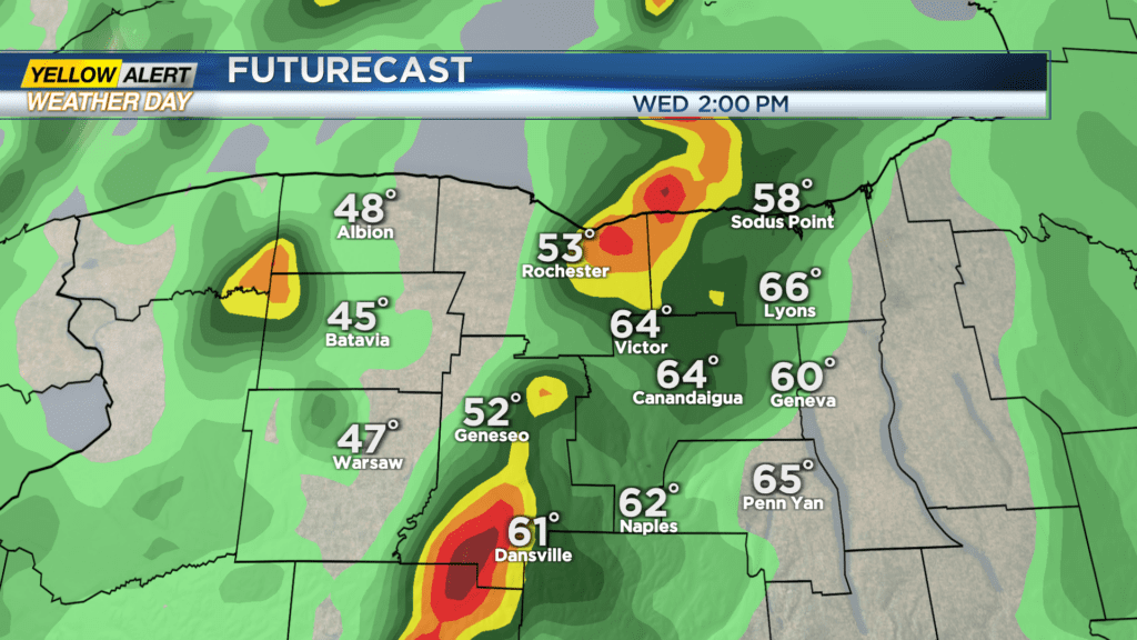
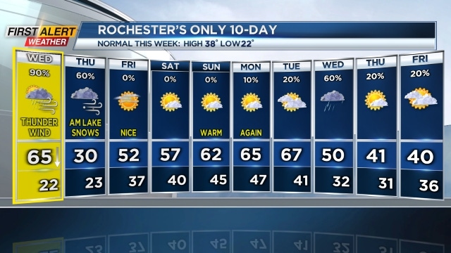
ROCHESTER, N.Y. — We’re tracking scattered showers and a rumble of thunder on Wednesday morning, then some clearing skies midday as temperatures make a run at another record high in the mid 60s.
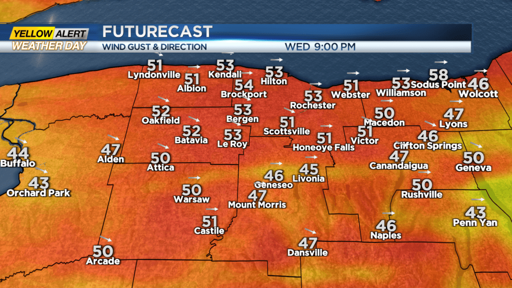
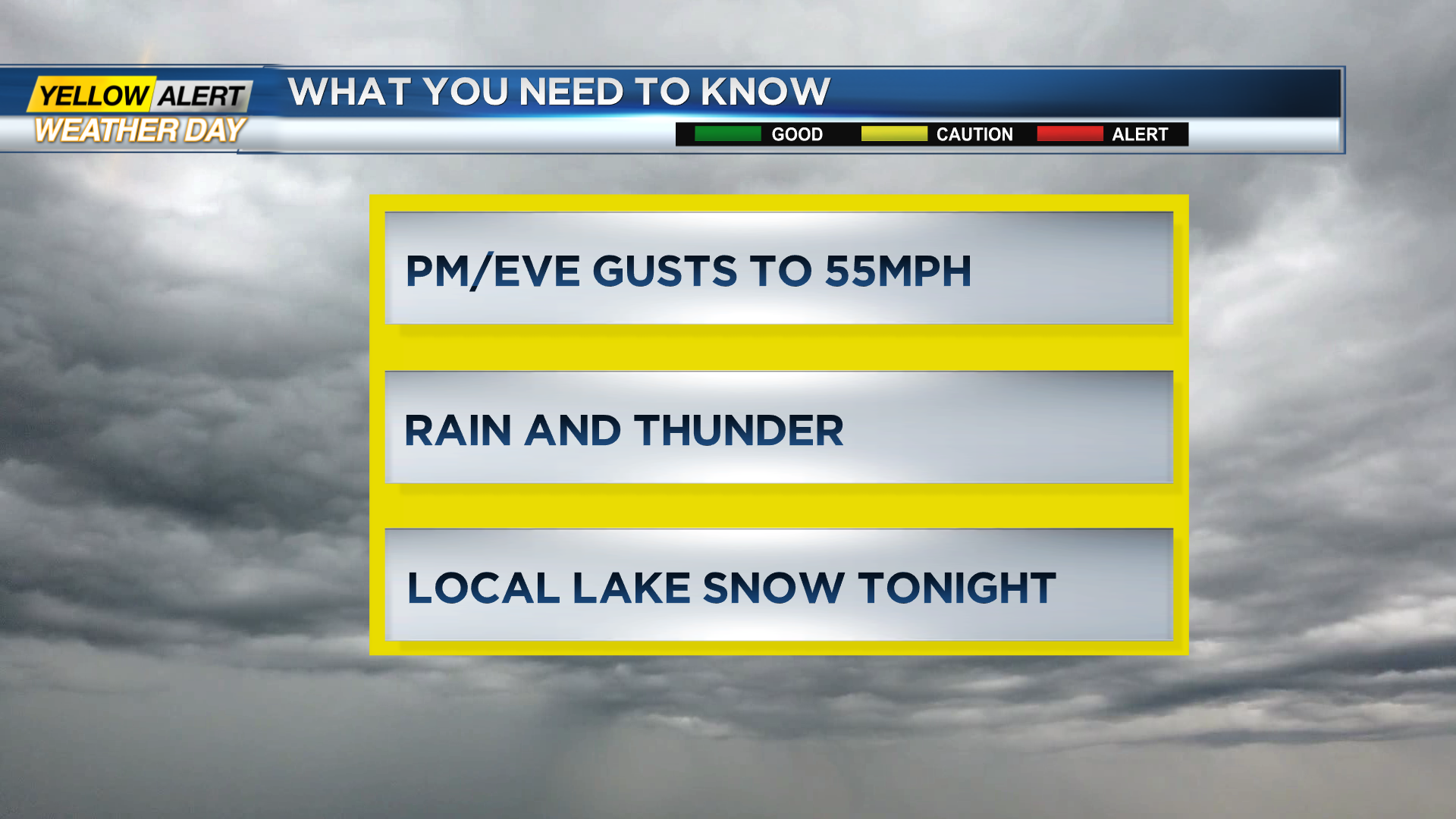
We’re tracking a strong cold front that will arrive between 1 and 2 p.m. with a brief downpour and even a possible thunderstorm. Behind the front, temperatures will tumble as the wind picks up with gusts over 50 mph in the afternoon into Wednesday night before subsiding around midnight.
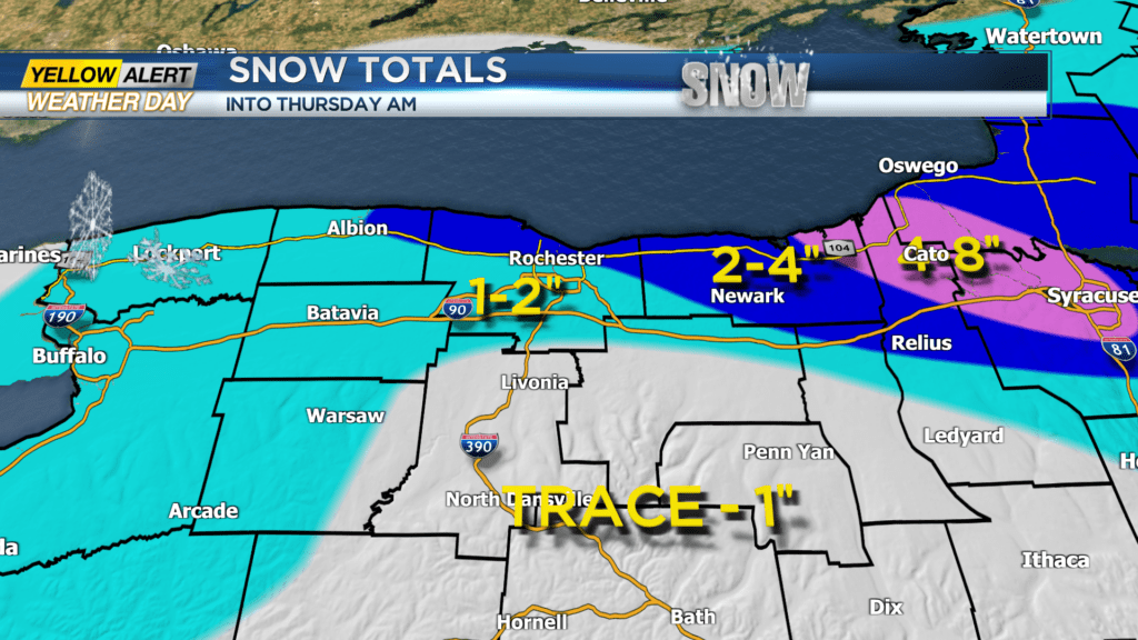
Snow showers will develop in the colder air and a few slick spots may develop after 5 p.m. Most of us will see just a coating of snow but a decent Lake Ontario snow band will try and organize on Wednesday night into Thursday morning.
This band may briefly impact the 104 corridor in Rochester with an inch or two into Thursday morning with higher totals likely in northeastern Wayne County where 4-8 inches are possible through the day on Thursday.
After that, the weather settles down nicely Friday into the weekend with another major warm-up into early next week. Stay tuned to News10NBC for the latest updates on the timing of the front, stronger winds and the development of the lake snows on Thursday.