Yellow Alert Weather: Wintry mix is falling and roads are turning slick. Cancellations and closings are coming in
[anvplayer video=”5152995″ station=”998131″]
A wintry mix has started to fall in many parts of the region. The rain, sleet, and snow are expected to increase further into Thursday afternoon as roads are becoming slicker. Here’s what you need to know about the incoming snowfall.
UPDATES
2:10 PM: New York State Police have issued a travel advisory for Ontario County I-90 eastbound. The advisory is between Exit 46 for Rochester I-390 and Exit 45-Victor I-90. All lanes are blocked due to a jack knifed tractor trailer. It’s an Approximately 3-mile traffic delay.
Closings and Cancellations
Local school districts and others have canceled activities or closed because of the snowfall. You can see a list of cancelations here.
Forecast (updated at 12PM)
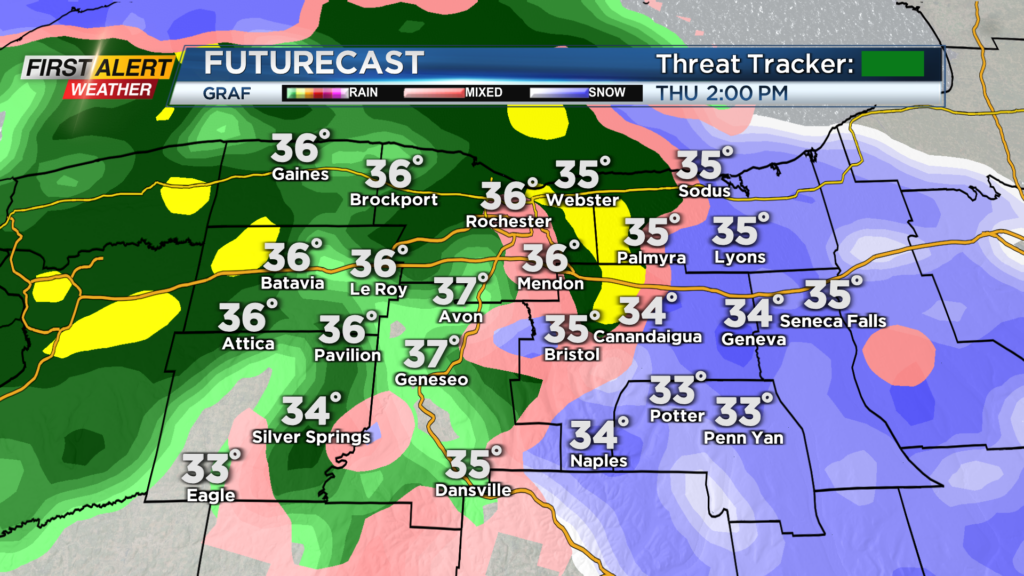
The precipitation has begun in the form of rain for many of us. Most of the early Thursday afternoon will be filled with rain as surface temperatures and low level atmospheric temperatures remain above freezing.
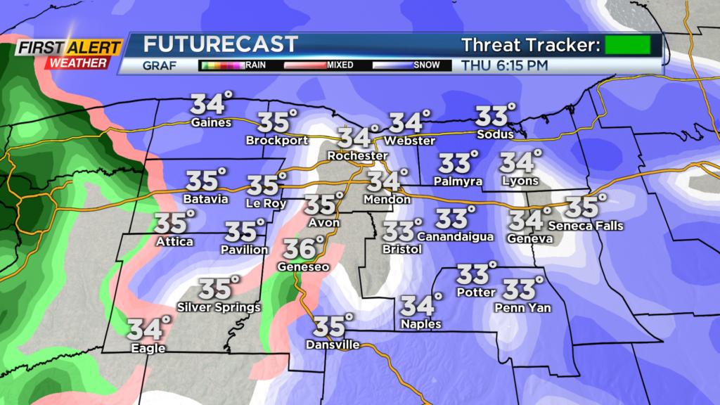
We will begin to see a mixture of rain/sleet/and snow towards 3 p.m. in the afternoon and it still looks like we will transition all to snow by the evening commute.
Snow for Thursday evening will still be heavy at times and continue through before transitioning over to widespread snow showers for Friday morning.
Snow showers will continue through much of Friday which could add light accumulations. In terms of accumulations for this storm, mixing will continue to play a large role.
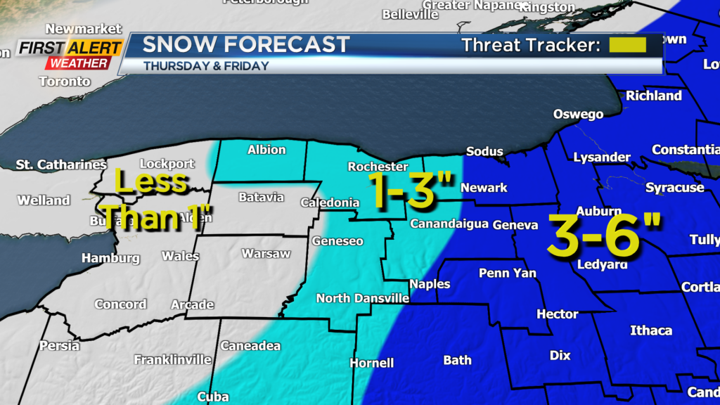
Because of the milder set up locally, we have trimmed down accumulations for some with less than 1″ expected for areas southwest of Rochester.
As for most of the region, we are still expecting light amounts of 1″-3″ and then for the eastern part of our viewing area 3″-6″ will be possible with the extra accumulation coming as the East Coast low takes over.
As far as the commutes, this evening will be a bit slick with near an inch of snow on the ground along with the mixture of sleet. For tomorrow morning, we will be looking at slick roads as well with added accumulations and snow showers continuing through the day Friday.
Winter driving tips
AAA and RG&E are offering drivers advice to stay safe as we head into this first major snow event of the season.
For starters, slow down. Increase the space between your car and other vehicles around you
and when you use your brakes, turn the wheel so you don’t lock up your car.
AAA also encourages you to make sure you have a snowbrush and ice scraper. Also include jumper cables, a blanket, a flashlight, a shovel, kitty litter, sand, or mats in your emergency kit.
Tweets from our team
To see the latest updates, you can follow members of our First Alert Weather Team and reporters.
______________
Download the WHEC First Alert Weather app to stay up to date while on the go.
Watch the latest full forecast online.