First Alert Forecast: Another 24 Hours of Pleasant Weather
[anvplayer video=”5128564″ station=”998131″]
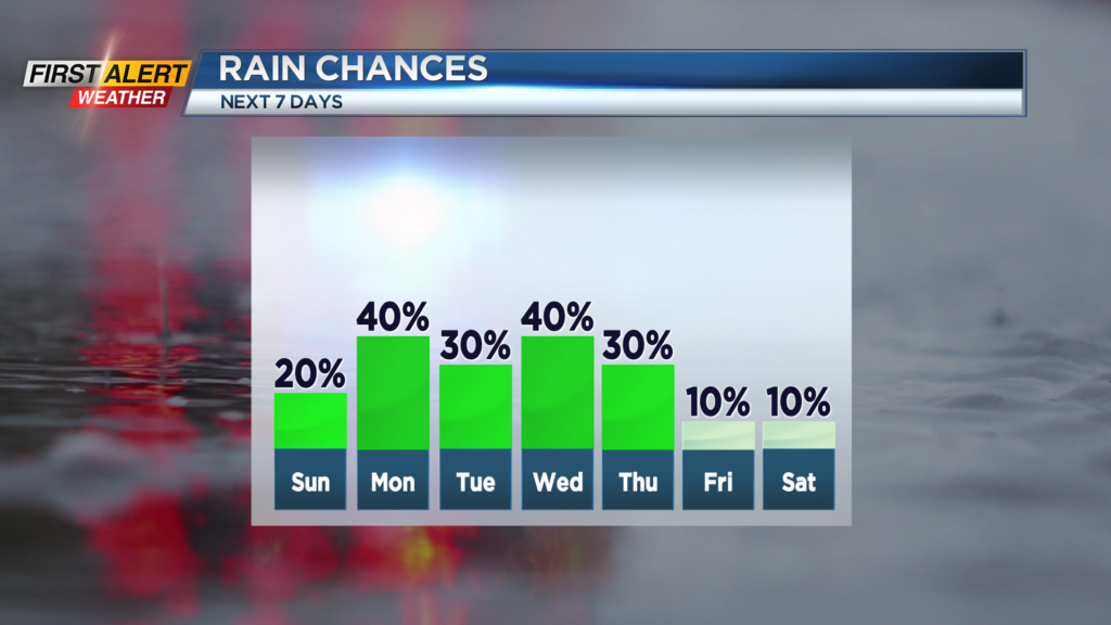
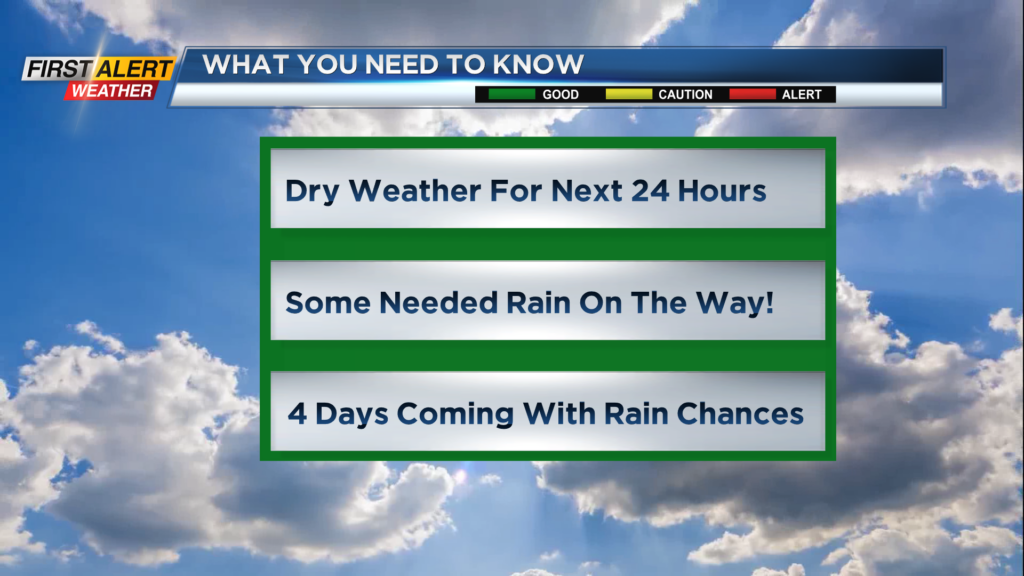
Today will make five days in a row with lower humidity and comfortable temperatures. A large area of high pressure continues to drift east across the northeast and will provide one more day of pleasant weather. However, early next week an upper level low pressure system will move into the area and anchor itself along the New England coast. This weather feature will bring more clouds and higher chances for rain showers. Although not ideal weather, this is some much needed rain that will be possible for Western New York.
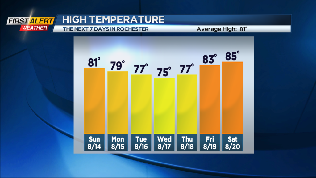
This evening look for skies to be clear at times early then patchy clouds arrive for the overnight. It will be another cool night with the low temperature in the middle 50s. Sunday will feature partial sunshine for the balance of the day with the high temperature within a few degrees of 80. Monday will bring a mix of clouds and sunshine with the increasing chance of a few showers and maybe a few thundershowers. The high temperature is expected to reach the upper 70s. The threat of showers and thundershowers will continue for Tuesday, Wednesday and early Thursday. This rain will be on the order of “hit and miss” type showers. In all likelihood our weather will then dry-out by Friday and continue into the weekend.
Stay tuned to News 10NBC First Alert for updates on the forecast.