First Alert Weather: A few light rain/snow showers for Easter weekend
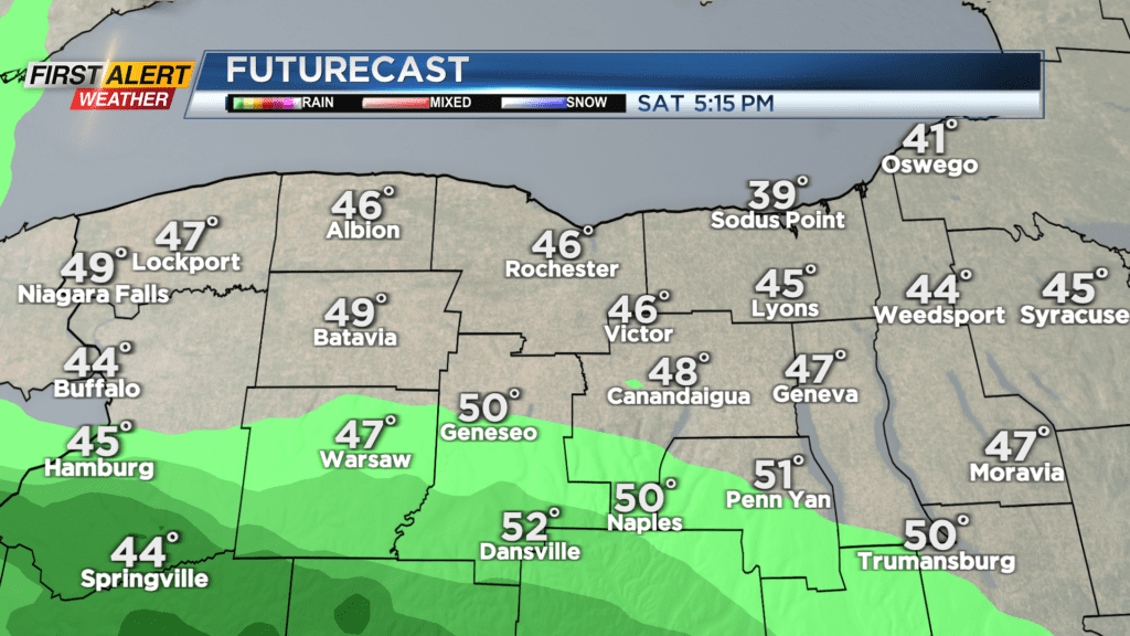
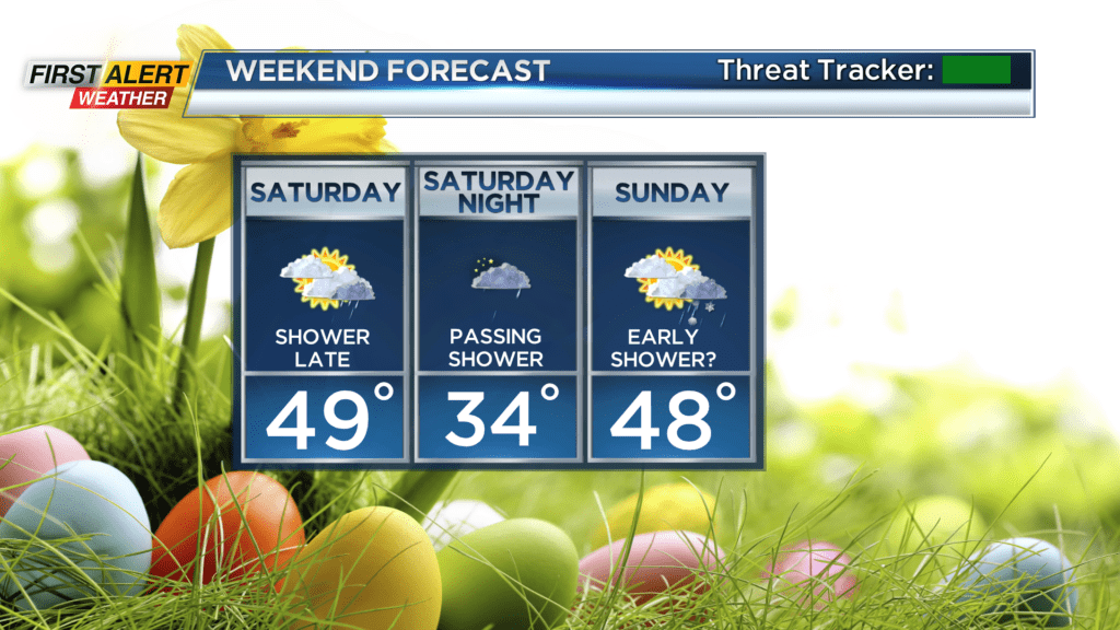
High pressure will be overhead, so we’ll see dry weather and some sunshine to start the weekend. An area of low pressure passing overhead will bring clouds by Saturday afternoon, followed by a few rain showers Saturday evening and overnight. There may be enough moisture left over by Sunday morning to keep a lingering rain or wet snow shower, but this should be brief and light, and we’ll see some sunshine returning into Easter Sunday afternoon. Temperatures both days will reach the mid and upper 40s, which is seasonable, and start off in the lower 30s. Pretty average for a late March Easter holiday.
Monday will be fairly quiet with a mostly cloudy sky, but we will be tracking a warm front with rain to our south. A few of these showers may try to sneak in. Tuesday will feature rain, and could be fairly steady at times. This doesn’t bode well for the Red Wings home opener at Innovative Field, but there’s still some time to work on changes in the forecast! If Tuesday’s game is postponed, the weather on Wednesday isn’t looking much better, with rain and wet snow showers, and wet snow showers and a brisk wind on Thursday. A fairly impressive storm system will be developing, and will likely bring a late season accumulating snow to interior New England, and possibly some for us here in the Finger Lakes region on Thursday.
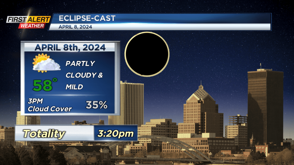
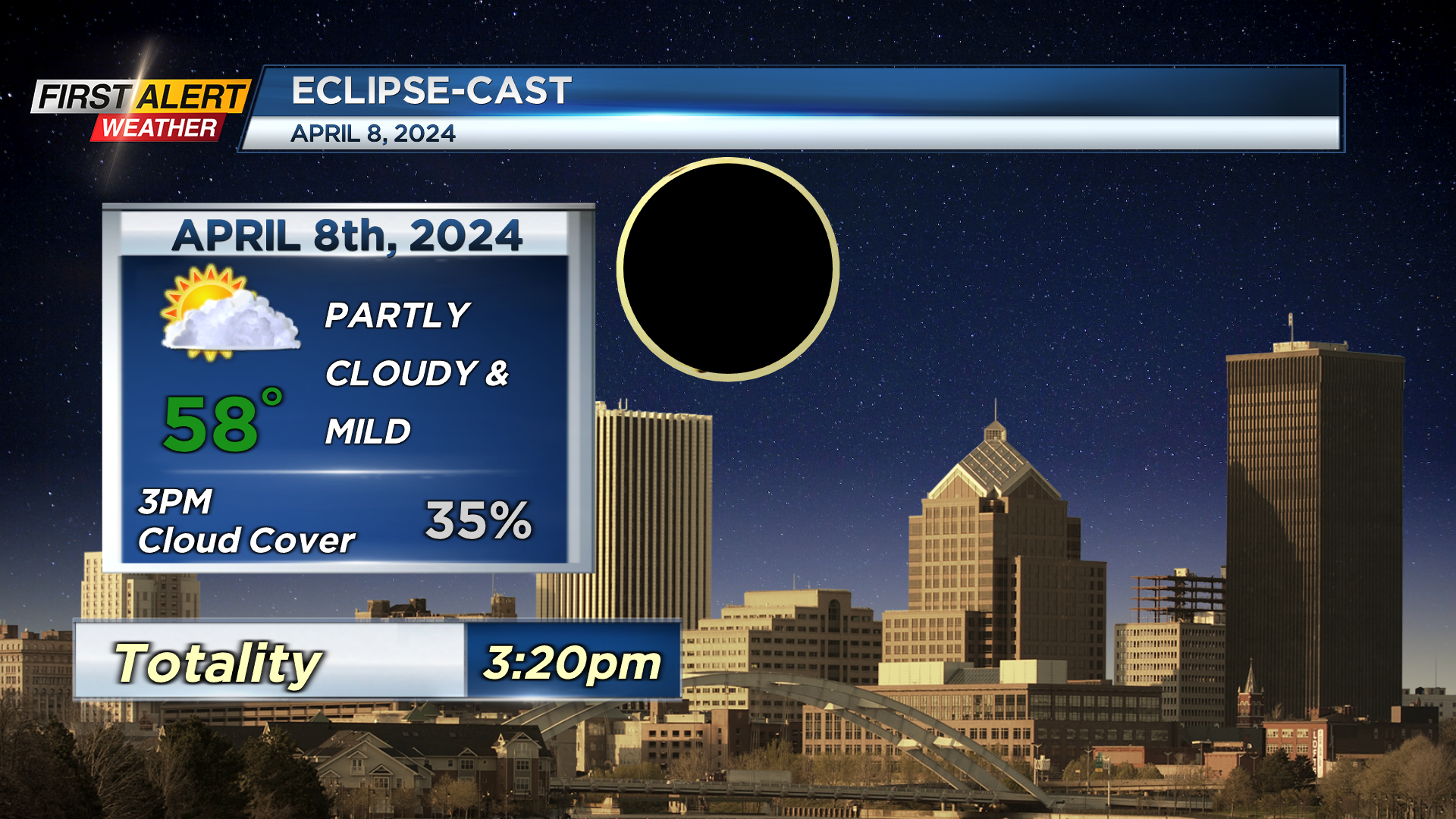
We’re also getting our first look at the eclipse forecast, which, at this very early stage, looks promising with a partly cloudy sky and temperatures in the upper 50s to near 60. Keep checking back daily, as this forecast will change somewhat!