First Alert Weather: Back to summer to end the week and open up the Labor Day weekend
[anvplayer video=”5132564″ station=”998131″]
ROCHESTER, N.Y. We welcomed in September and meteorological fall with a bit of a fall feel the air, as high temperatures stayed in the 60s for much of the day.
We’ll drop into the 50s overnight, but roar right back into summer by Friday, with afternoon highs back into the 80s. Saturday will be the winner of the Labor Day weekend, with dry weather, a mix of clouds and sun, and highs well into the 80s.
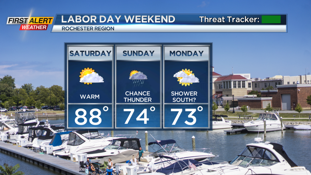

Sunday and Monday will feature highs back in the 70s with more clouds around, and a few showers, or perhaps thunder, especially on Sunday as a weak cold front passes through.
Monday may stay dry in the Rochester area, with the best chance for some showers in the Finger Lakes, along that old cold front. So, the holiday weekend is far from a washout, but if you have plans outside, you may need to take into consideration the threat for a little wet weather.
As we head into the first full week of September next week, we’ll see seasonable temperatures in the mid and upper 70s, with some passing showers or isolated afternoon thunder, but nothing major as far as big rain or storm threat. With that, we’re green on the First Alert Threat Tracker.