First Alert Weather: Back to Winter this weekend
[anvplayer video=”5168375″ station=”998131″]
ROCHESTER, N.Y. – Waking up this morning to temperatures in the mid and low 30s under cloudy skies. Temperatures the past couple of days have been able to turn milder in the afternoon, but today is a different story.
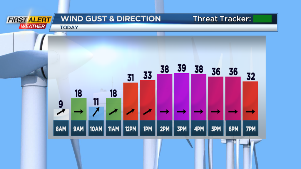
We are back to winter as temperatures only make their way into the mid and upper 30s this afternoon. Not only will we be dealing with chilly temperatures, but we will also be dealing with the wind which will make it feel much cooler. Winds will increase through the afternoon hours and gust upwards of 40 mph. Our power outage risk is limited as the biggest story with the winds will be the feels like temperatures.
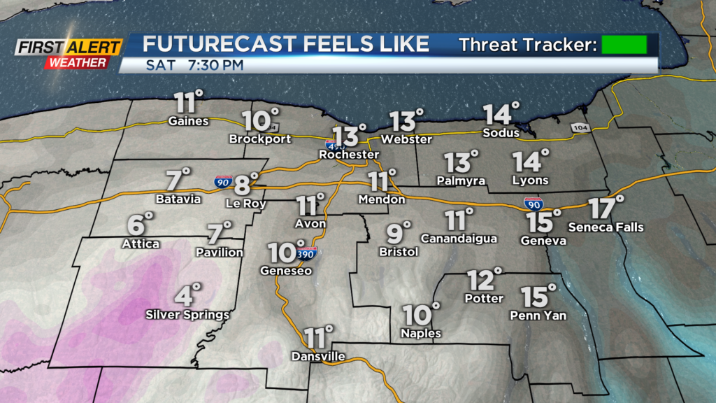
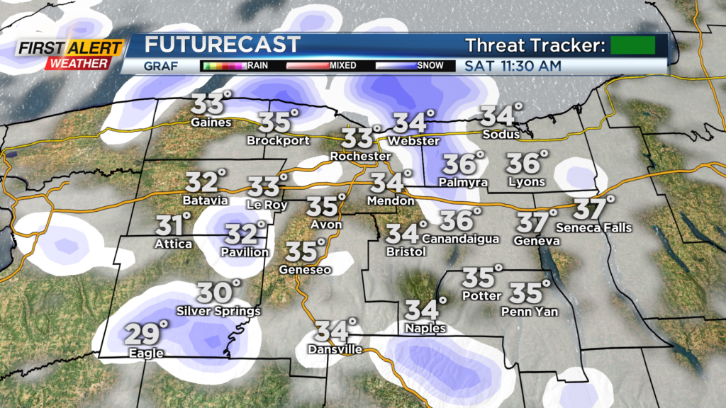
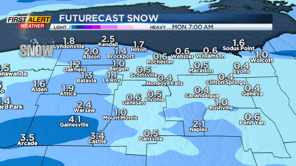
Wind chills this afternoon will be in the 20s, but then dip into the teens and single digits this evening. Along with the cold and wind, we will also see snow showers this afternoon and tonight. No big impacts are expected to our region, but occasional snow showers will be likely this afternoon, through tonight, and into Sunday. Snow totals will be limited with upwards to an inch or two for many. However, folks in Wyoming County could see upwards to five inches when things are done Sunday afternoon.
Also, the wind and cold will continue for Sunday with wind chills likely in the teens and single digits through the day as gusts continue to gust upwards of 40mph. A Winter weekend this weekend, but Spring starts Monday and it will feel like it!