First Alert Weather: Brace for temperature drop overnight; Yellow Alert starts Monday

ROCHESTER, N.Y. — For the first time in more than two weeks, the temperature in Rochester reached 40 degrees on Saturday. It has been a nice break from the mid-winter conditions, but that is all set to change.
The arctic air will make the first push into Western New York on Saturday night with a rapid drop in the temperature expected. A concern this evening will be the potential for a flash freeze after a day. Watch for icy spots for this Saturday night.
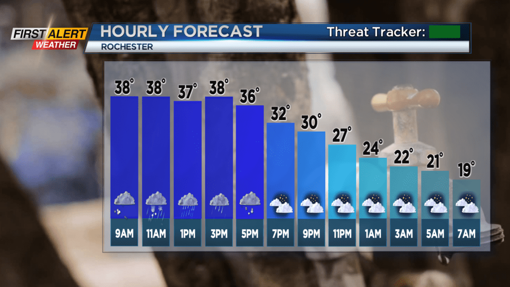
The weather should be relatively calm and very cold for the daylight hours on Sunday, but lake snow is set to arrive Sunday night into early Monday with several inches of accumulation possible. This bitter cold weather will last for at least a few days with the wind chill, at times, running subzero right into Wednesday. As a result, the News 10NBC First Alert meteorologists have issued a yellow alert for Monday, Tuesday and Wednesday.
On Saturday night, look for passing flurries with a rapid drop in the temperature. The mercury will fall into the teens with any untreated roads possibly experiencing a flash freeze overnight. Sunday will bring cloudy skies and passing flurries with the temperature near 20 degrees.
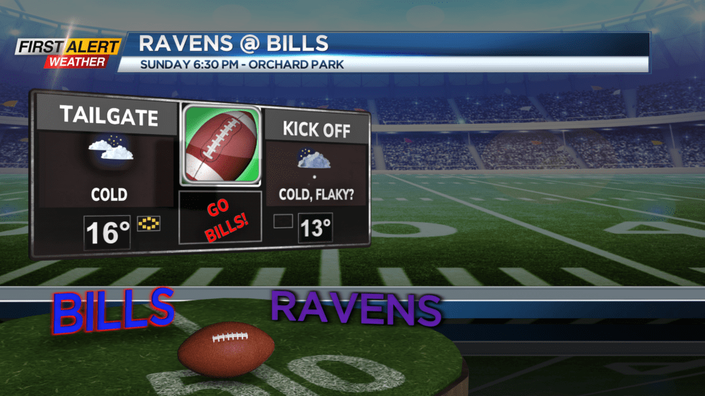
If you are heading to the Bills game at Highmark Stadium it will be frigid with temps in the teens and the wind chill in the single digits. Go Bills! Expect occasional lake snow developing later Sunday night with several inches of accumulation possible by Monday morning. Then just a “steady dose” of harsh winter conditions for Monday, Tuesday and Wednesday with the wind chill going subzero at times.
Stay tuned to News 10NBC First Alert weather for updates on the forecast.