First Alert Weather: Cool, crisp air to end the week
[anvplayer video=”5135031″ station=”998131″]
ROCHESTER, N.Y. (WHEC) — A cold front passing through Wednesday evening will bring a distinct feel of fall to the air Thursday and Friday.
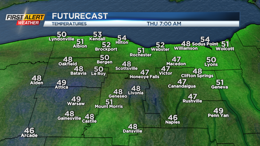
Temperatures will drop into the lower 50s near Rochester, and 40s south by Thursday morning, and only warm into the lower half of the 60s. Still, it’ll be a beautiful looking day, with any morning lake clouds giving way to an abundance of sunshine with high-pressure overhead. Friday should warm back into the 70s after starting in the 40s and 50s once again. We’ll see a few more clouds around, as a weak front approaches, but expect to stay dry.
The weekend: the weekend still looks pretty good, with a mix of clouds and sun on Saturday and highs returning to the lower 80s. A few showers may sneak into the area on Sunday, as a wave of low pressure approaches. So, at this point, the weekend looks ok, but you may need to plan around a few showers on Sunday. A few showers or storms will continue into Monday, followed by mainly dry weather returning Tuesday through at least Wednesday. The timing of our next front will play a role in how warm we get next week, and how long that warmth lasts. At this point, we should stay in the 80s through Thursday or Friday, then drop back for next weekend.