First Alert Weather: Easter Sunday looking mainly dry
We continue to watch several waves of low pressure moving from west to east along a near stationary front. This brings some precipitation from time to time, but initially this front is far enough to the south that any precipitation will be very minimal over the next 24 hours. However, this front will begin to move closer to Western New York by Tuesday and Wednesday. This means the probability of rain will increase substantially by mid-week. Eventually marginally colder air will arrive by Thursday changing this to wet snow showers. Winter is not finished with Western New York just yet.
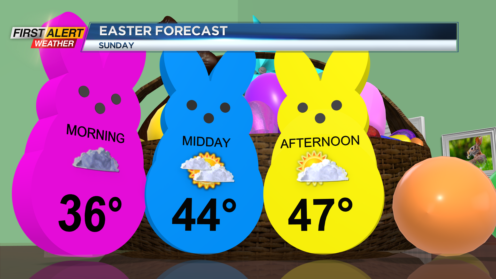
Saturday night, look for a few sprinkles or a light rain shower south of Rochester. Most of the immediate Rochester community should remain dry for the overnight. The low temperature will be in the middle 30s. Easter Sunday may see a few lingering rain showers for the morning south of Rochester. Otherwise, look for gray skies to give way to a few sunny breaks for the afternoon. The high temperature will be in the upper 40s. Monday may bring a spotty rain shower; otherwise we will see gray skies with a temperature in the middle 40s. Tuesday and Wednesday will bring a much higher probability of rain and temperature readings will be in the low to mid-40s.
Then it will turn colder for Wednesday night and Thursday with wet snow showers likely. A small accumulation is possible, especially during the overnight hours. It will feel like winter, as most of the time temperatures will be in the 30s.
Stay tuned to News10NBC First Alert weather for updates on the forecast.


