First Alert Weather In-Depth: Intense Lake Erie Squall
[anvplayer video=”5148125″ station=”998131″]
ROCHESTER, N.Y. If you have lived in Western New York for any length of time, you know lake effect snow. But do you really understand the mechanism that is involved with the lake effect snow?
The big driving force comes down to a temperature differential if we have the lake water temperature at 50 degrees and then very cold air crossing the great lakes. In this instance, it is 20 degrees colder. Then warm air wants to rise, almost like a hot air balloon.
In addition, depending on the wind direction, this lake effect streamer could move toward your local neighborhood. There are a couple of scenarios of how this lake snow could impact the area. There could be multiple bands of snow and that usually covers a broader area with a little bit less intensity.
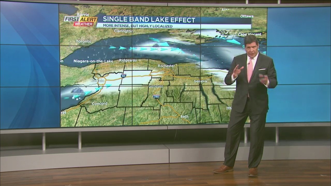
However, in this particular event, the News10NBC meteorologists are looking at a single band of snow. This can be much more intense and this weekend it will arrive off of Lake Erie. This will be affecting communities primarily to the west of Rochester.
There is the potential for shutting portions of the New York State Thruway. These closures would be due to the intensity of snow with the rate of snowfall pushing 2 to 3 inches an hour at least in the communities that are closer to Lake Erie. Again, this is not for the immediate Rochester area but would be for points to the west of Rochester, especially toward Batavia.
If you live or plan on traveling in this portion of the state consider the rapidly changing conditions, zero visibility at times with near whiteouts. There is a great likelihood of very difficult driving with some road closures.
And if the snow comes down heavy enough in one area, for a long period of time there may even be the potential for some heavy roof loads due to the snow. We have seen before when homeowners try to shovel their roofs. Not a good idea when it comes to safety.