First Alert Weather: ‘One and done’ for the cold weather
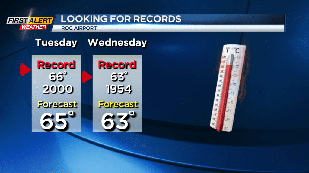
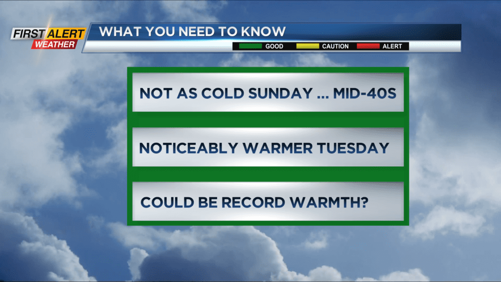
Across Western New York the temperature never got out of the 20s Saturday. That was in sharp contrast to Friday’s 50-degree weather. However, the very cold northerly wind will shift to the south later Saturday night and Sunday, bringing a moderation to the chill. In fact, the warmth will keep coming by the middle of the week with temperatures likely pushing into record territory by Tuesday and Wednesday.
Saturday night, look for mainly clear, moonlit skies. The low temperature will be in the middle teens. Sunday you can expect a mix of clouds and sunshine. Not as cold with the high temperature in the middle 40s. Monday looks dry with the temperature remaining in the mid to upper 40s. Once we reach Tuesday and Wednesday the temperature could be pushing into record a high temperature. Both days will likely be in the 60s, but rain showers are expected.
Stay tuned to News 10NBC First Alert weather for updates on the forecast.