First Alert Weather: Rain, rumbles and cooler air make a return
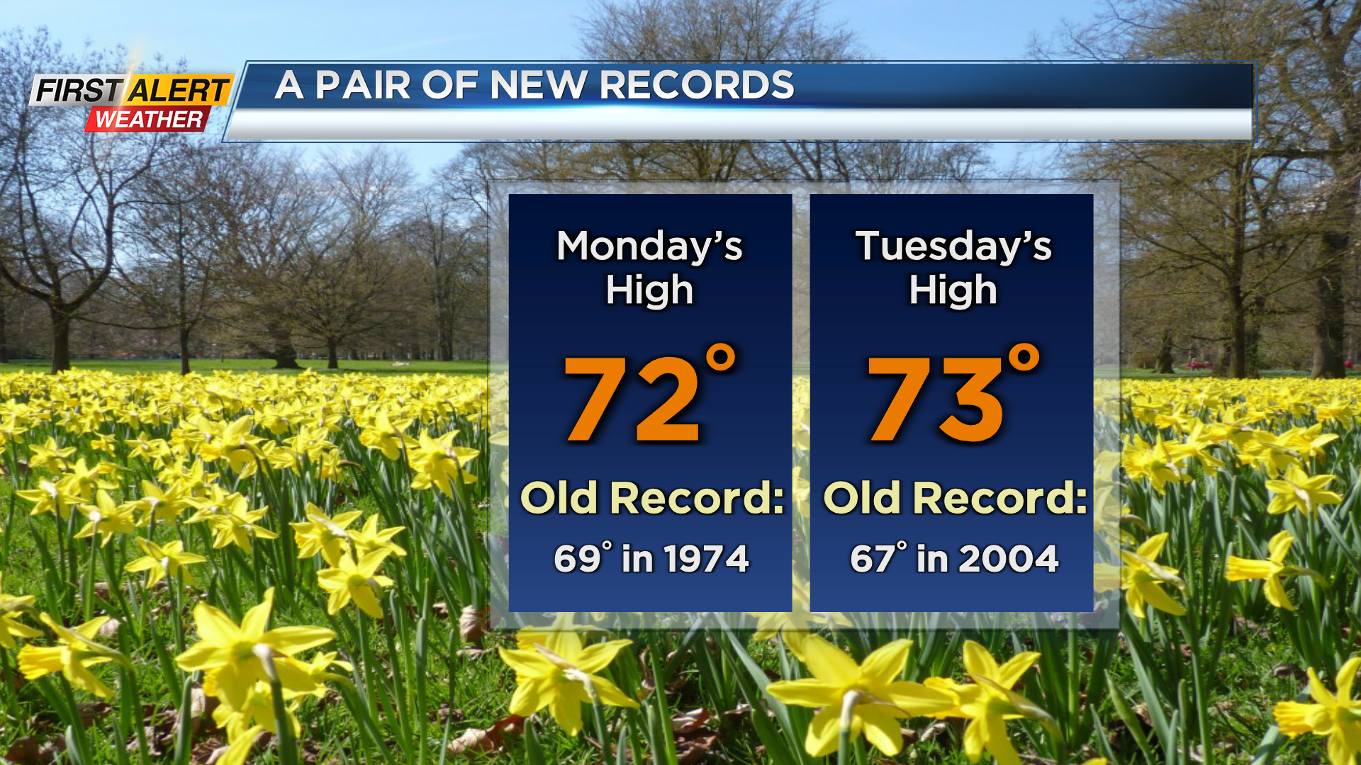
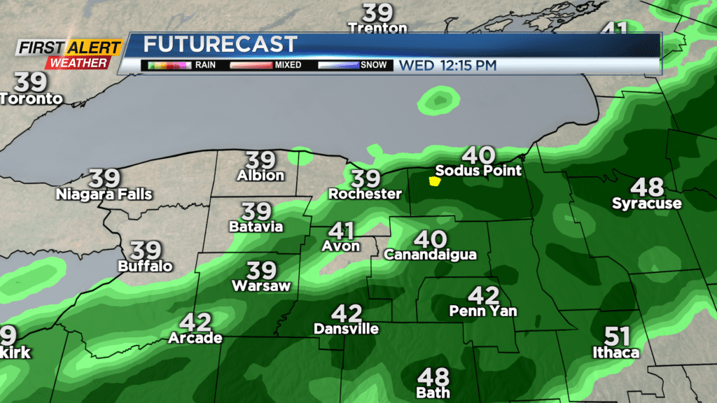
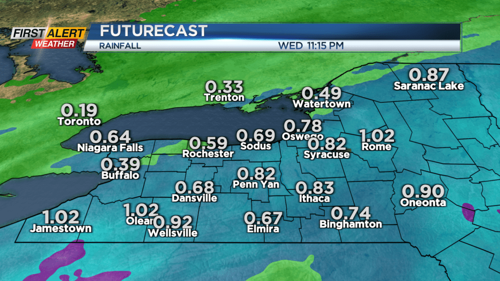
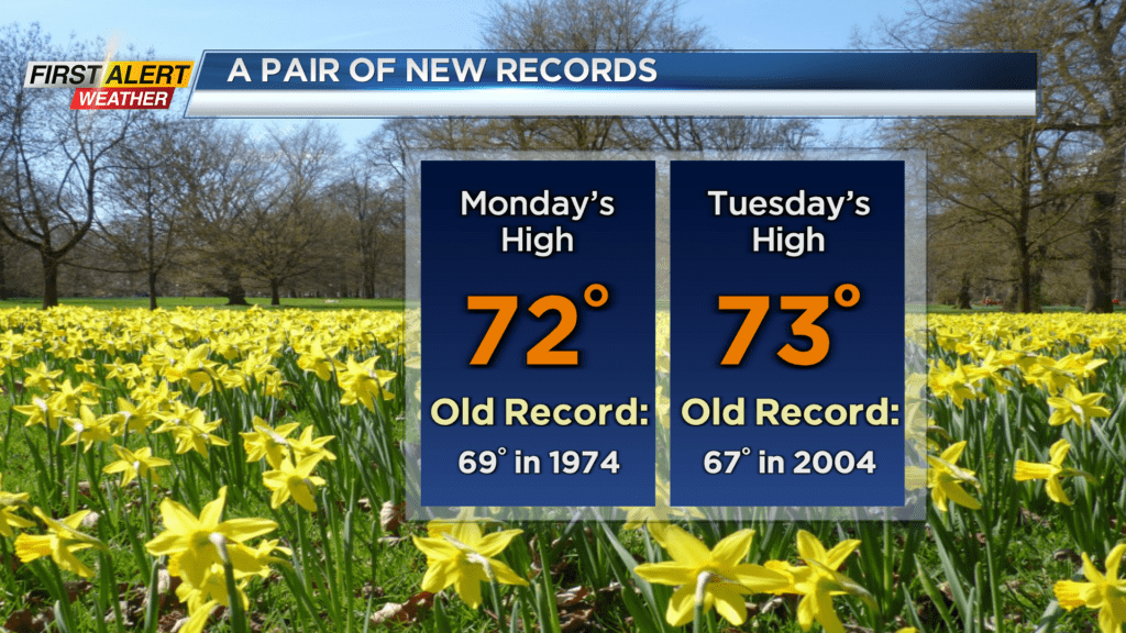
Tuesday saw a second consecutive day in the 70s, and a second day in a row of record warmth. A cold front moving in tonight will not only bring some rain and rumbles, but a big change to our temperatures come Wednesday. Rain will become steady for a period on Wednesday afternoon, especially in the Finger Lakes, where a half inch of rain is possible. Closer to Rochester, the rain will be a little more showery (but still steady for a period), with most spots closer to Rochester and points west picking up a quarter inch of rain. More importantly, temperatures will be falling steadily from midnight into Wednesday, with much of the daylight hours in the lower 40s. Rain should move away Wednesday night, leaving us with just clouds to start Thursday. We’ll see some sunshine returning Thursday afternoon, and lasting into Friday. Temperatures will be a little chillier on Thursday, but still above average in the mid 40s, then climbing into the 50s on Friday.
The weekend goes downhill with rain likely on Saturday, and some wet snow showers mixing with rain showers on Sunday. It’ll turn chillier Sunday night into Monday, with some lake effect snow possible, even a minor accumulation to kick off Monday. That being said, we’re tracking another warm-up with temperatures climbing back into the 60s by the middle to the end of the week.