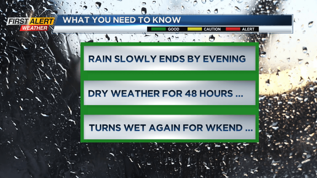
First Alert Weather: Rain will slowly end Wednesday evening

There is a frontal boundary located from Pennsylvania, across central New York State and then extending into northern New England. Significant amounts of rain will continue to stream in across that boundary right into western and central New York. The damp, soggy weather will linger until the front slowly pushes east later Wednesday evening. High pressure will then build into the area, providing about 48 hours of dry weather.
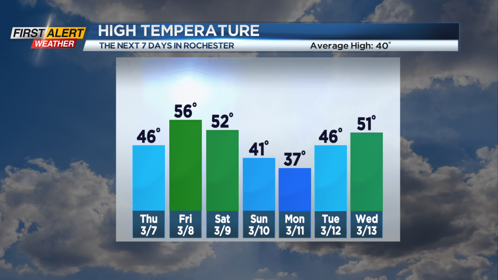
Wednesday night, look for steady light rain to come to an end from west to east for the middle of the evening. Then, just cloudy and a few spots of drizzle and fog for the remainder of the overnight. The low temperature will be in the upper 30s. Thursday you can expect gray weather for the morning, then skies will slowly begin to clear during the afternoon with the temperature rising into the middle 40s. Friday should feature more sunshine, although the clouds may begin to increase for the later portions of the afternoon. The temperature will warm into the mid-50s.
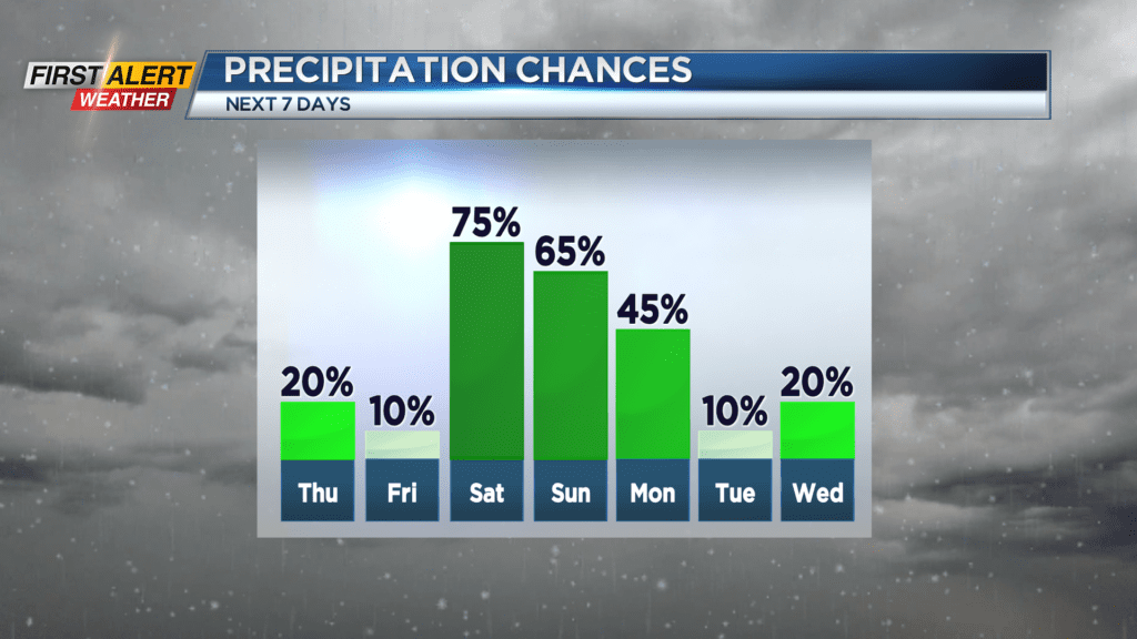
The next weather system will arrive for the weekend with another round of rain on Saturday. That rain will begin to change to wet snow on Sunday.
Stay tuned to News 10NBC First Alert Weather for updates on the forecast.