First Alert Weather: Showers and some storms to end the week
[anvplayer video=”5131284″ station=”998131″]
ROCHESTER, N.Y. (WHEC) — Showers and some thunderstorms will round out the work week, but we’ll start the weekend off fresh and cool.
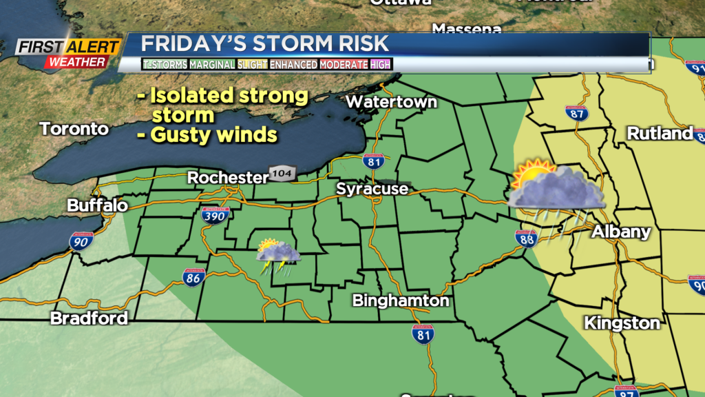
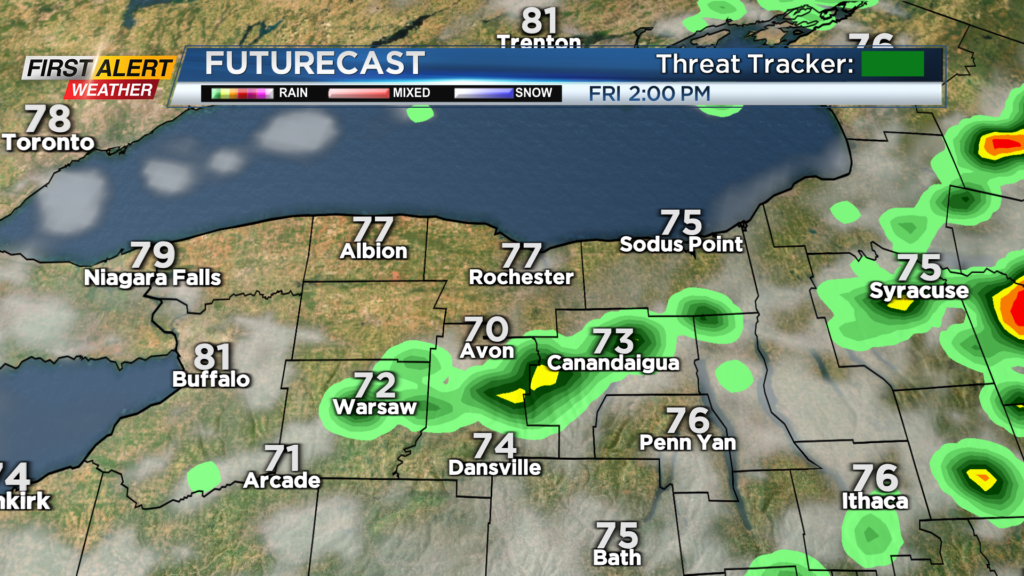
We’ll continue to see a few isolated showers and thundery downpours tonight ahead of our cold front. That front swings through the late morning into the early afternoon on Friday. It’ll bring with it a renewed threat of showers and storms. There’s a slight chance we could get one or two storms with gusty winds, but the severe threat is overall low, so we’ll remain green on the First Alert Threat Tracker. Once that front pushes through, we’ll begin to clear things out. That means a lovely start to the weekend. The only caveat is the possibility of a lake-enhanced shower early Saturday morning, but we’ll see sunshine returning quickly, with a fresh breeze.
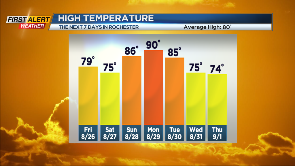
We’ll start to warm things up again by Sunday, with highs back into the mid-80s, and up near 90 on Monday. Another cold front Tuesday will bring another round of thunderstorms, followed by another round of fresh, almost early Fall-feeling air, with highs in the lower half of the 70s and overnight lows in the 50s.