First Alert Weather: Some storms tonight, then drier weather returns Thursday
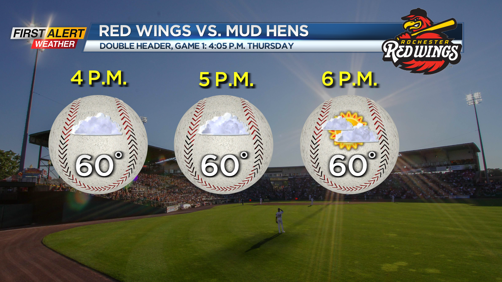
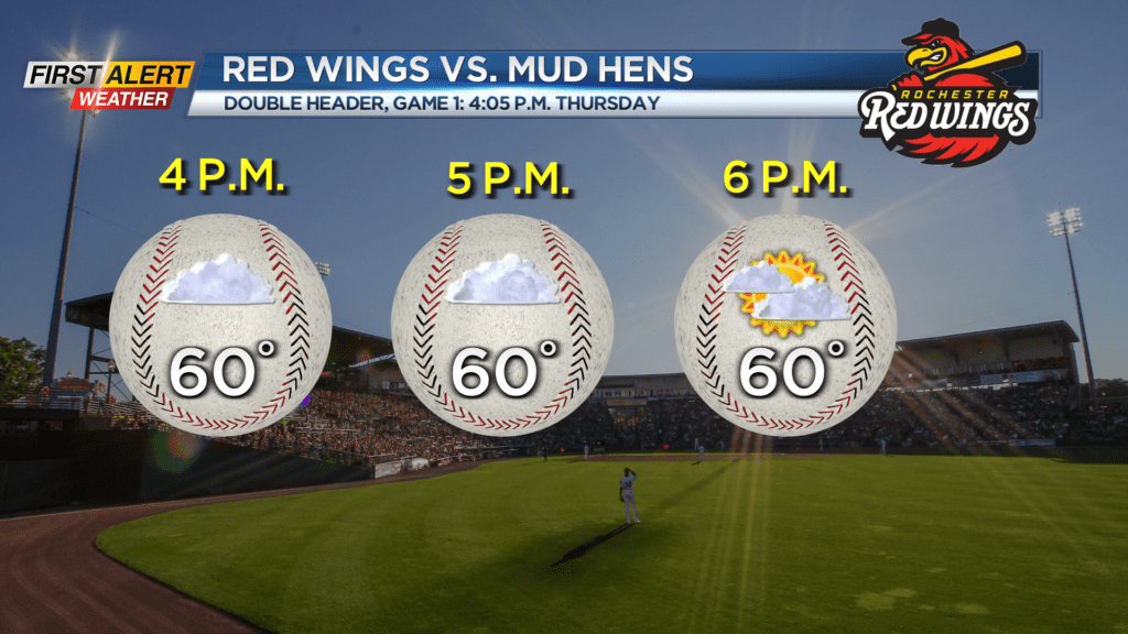
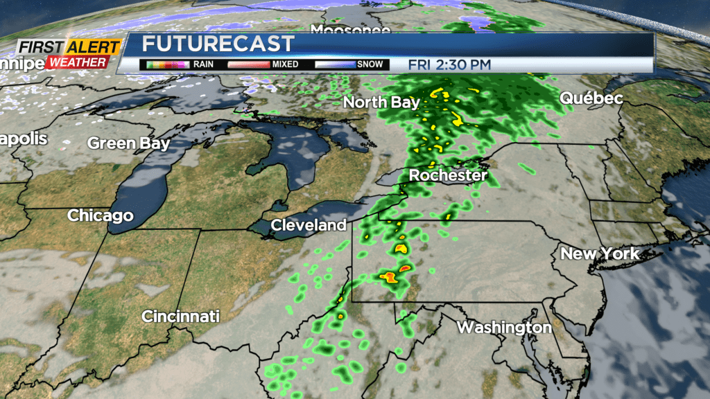
A line of severe storms marching through the Great Lakes will reach western New York by midnight, but will be weakening. So, while severe weather isn’t expected locally, we could still see a few thunderstorms with gusty winds, especially west of Rochester. Otherwise, it’ll be a breezy and very mild night with temperatures not dropping out of the lower 50s in most spots. This line of wet weather will be east of us to start Thursday, which means we’ll see a drier day, though a stray shower is still possible. We’ll see some limited breaks of sun, especially later in the day Thursday, and temperatures will climb into the upper 50s and lower 60s. A cold front moving through on Friday will bring another round of scattered showers, followed by temperatures dropping into the lower 50s.
The weekend is looking up! We’ll see a mix of clouds, and cooler but pleasant air. We could see a pop-up midday shower on Saturday; otherwise we expect a dry weekend. The nice weather will continue into Monday with a mostly sunny sky before some showers return again late Tuesday.