First Alert Weather: Sun through the weekend, then showers next week
[anvplayer video=”5128201″ station=”998131″]
ROCHESTER, N.Y. — Our weather will feature two completely different setups into this weekend and next week.
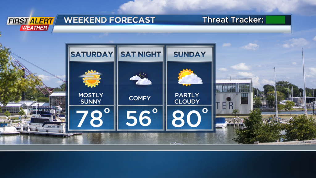
A huge area of high pressure over the Great Lakes moving in now will park itself overhead this weekend. That will bring us fair weather, with low humidity, mild air and loads of sunshine. Temperatures during the day will hold in the 70s, and we’ll fall well into the 50s overnight. Great weather to open up the windows and get some fresh air inside! Then, we’ll flip the script next week. An upper level disturbance will move in Monday into Tuesday, bumping up our rain chances each day. Clouds will win out, and with the frequent showers, temperatures will remain a little cool, in the lower half of the 70s. While almost each day will feature rain chances, no day will be a washout, and neither will the whole week. Rain chances will likely spike on Tuesday and Wednesday, with a slight drying trend on Thursday, and mainly dry weather by Friday.
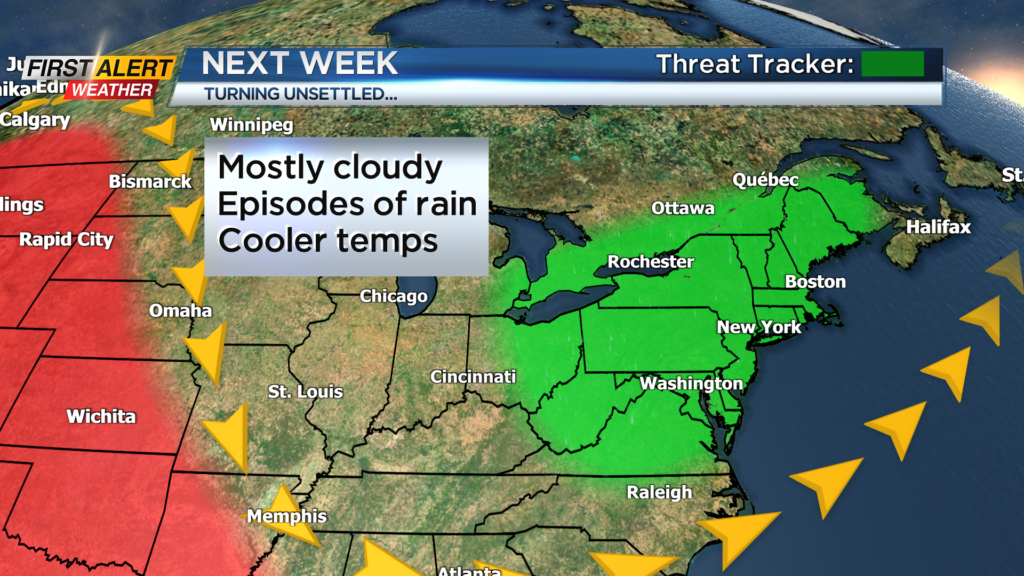
We’ll focus on timing out the wettest periods of the next week as we get a little closer to it. While this will bring us some beneficial rain during the work week, there doesn’t appear to be much flood potential or strong storm threat, so we’ll remain green on the First Alert Threat Tracker. It is still early in the extended forecast, but there are some signs that we’ll clear up nicely by next weekend. Stay tuned.