First Alert Weather: The next round of rain is heading for Western New York
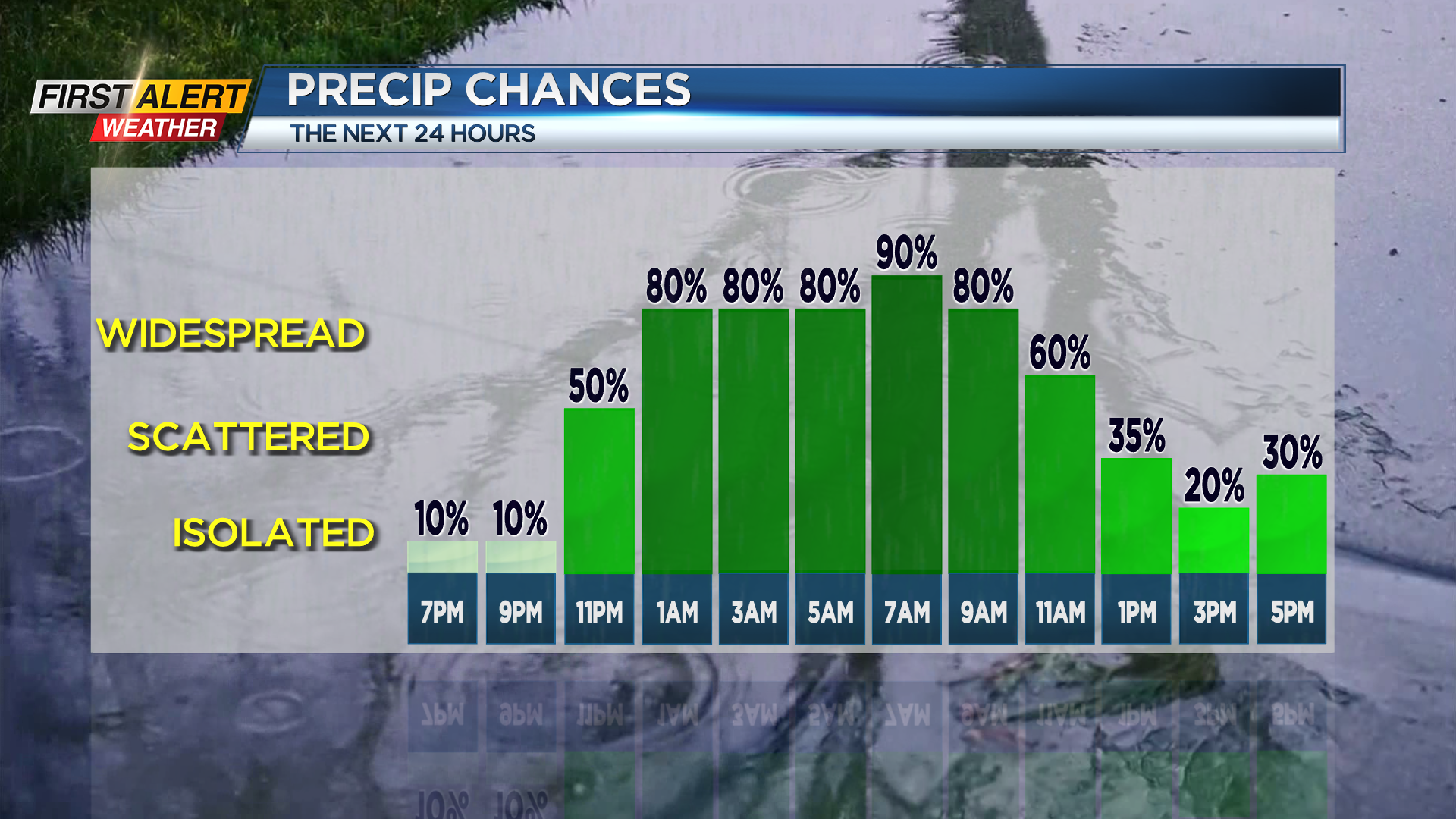
Rainfall has been very limited Saturday, but that is about to change. A slow-moving low-pressure system will be moving over the eastern Great Lakes for the next 24 hours. As a result, the probability of rain will be increasing later Saturday evening and for the remainder of the overnight. The rain will be with us for Sunday morning, before tapering to widely scattered showers Sunday afternoon. There is the potential for a quarter to half inch of rain by the end of the weekend.
Saturday night, look for dry weather early in the evening, then rain developing before midnight and continuing for the remainder of the overnight, with the temperature dropping into the lower 50s. Sunday morning the umbrella will be needed with more showers expected. These showers will become widely scattered for the afternoon. Much of the day will be in the 50s, but skies may brighten late in the afternoon with the temperature eventually reaching the lower 60s. The weather will improve significantly for Monday and Tuesday with more sunshine expected. Both days the temperature will be near 70 degrees.
The next round of rain arrives Wednesday, Thursday and Friday. Then sharply cooler temperature, unfortunately, is expected for the start of the Lilac Festival.
Stay tuned to News 10NBC First Alert Weather for updates on the forecast.


