First-Alert Weather: The weekend starts dry, but rain quickly returns
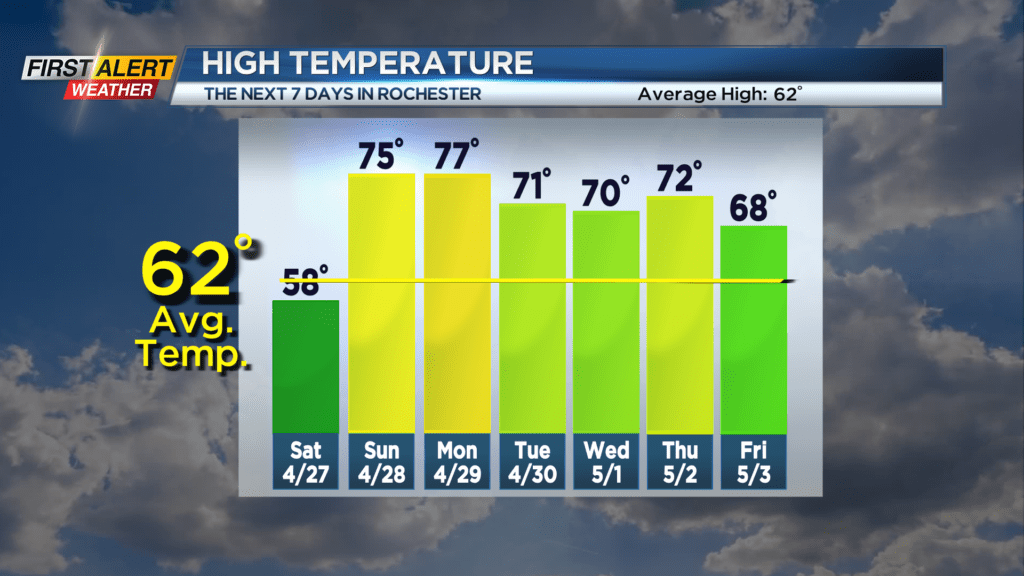
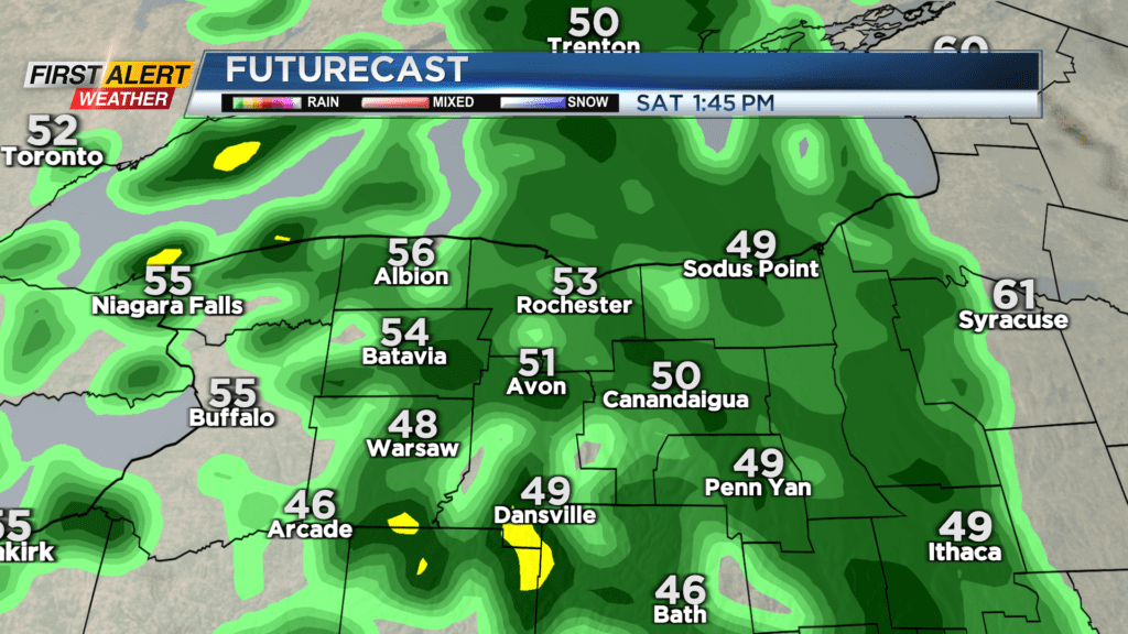
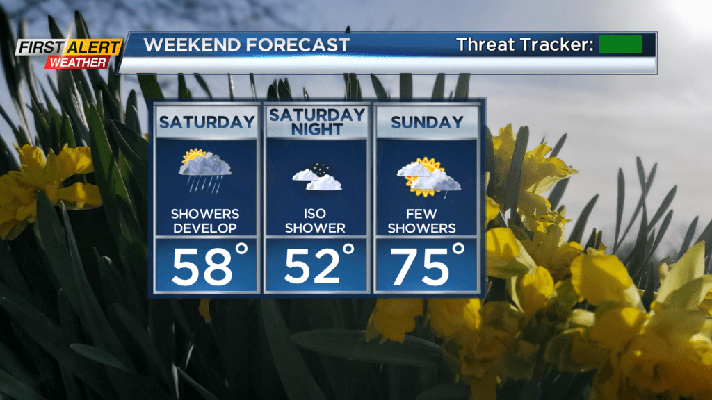
Our fair weather starts to go downhill a bit this weekend as warmer air works in. A warm front lifting through on Saturday will bump our temperatures into the 70s on Sunday, but we’ll have to deal with the rain that accompanies the warm front on Saturday. The first few hours of daylight will be dry, but showers will arrive from west to east during the morning hours. The wettest part of the day will be late morning into the middle of the afternoon before the steadiest showers taper. We may see another round of showers late in the day as that warm front lifts through. Temperatures on Saturday will remain in the upper 50s and lower 60s, before climbing on Sunday.
Sunday won’t be completely dry, but a few passing showers will be possible along a boundary, with the best chance for a rumble of thunder in the Southern Tier.
Monday remains warm and mainly dry with temperatures in the 70s to near 80, though that warm front may sag southward just a bit, keeping us cooler north of Rochester. Showers pick up on Tuesday with the cold front passing by, followed by drier weather on Wednesday. Overall, our temperatures will stay on the mild side for much of next week.