First Alert Weather: Weather is changing and not for the better
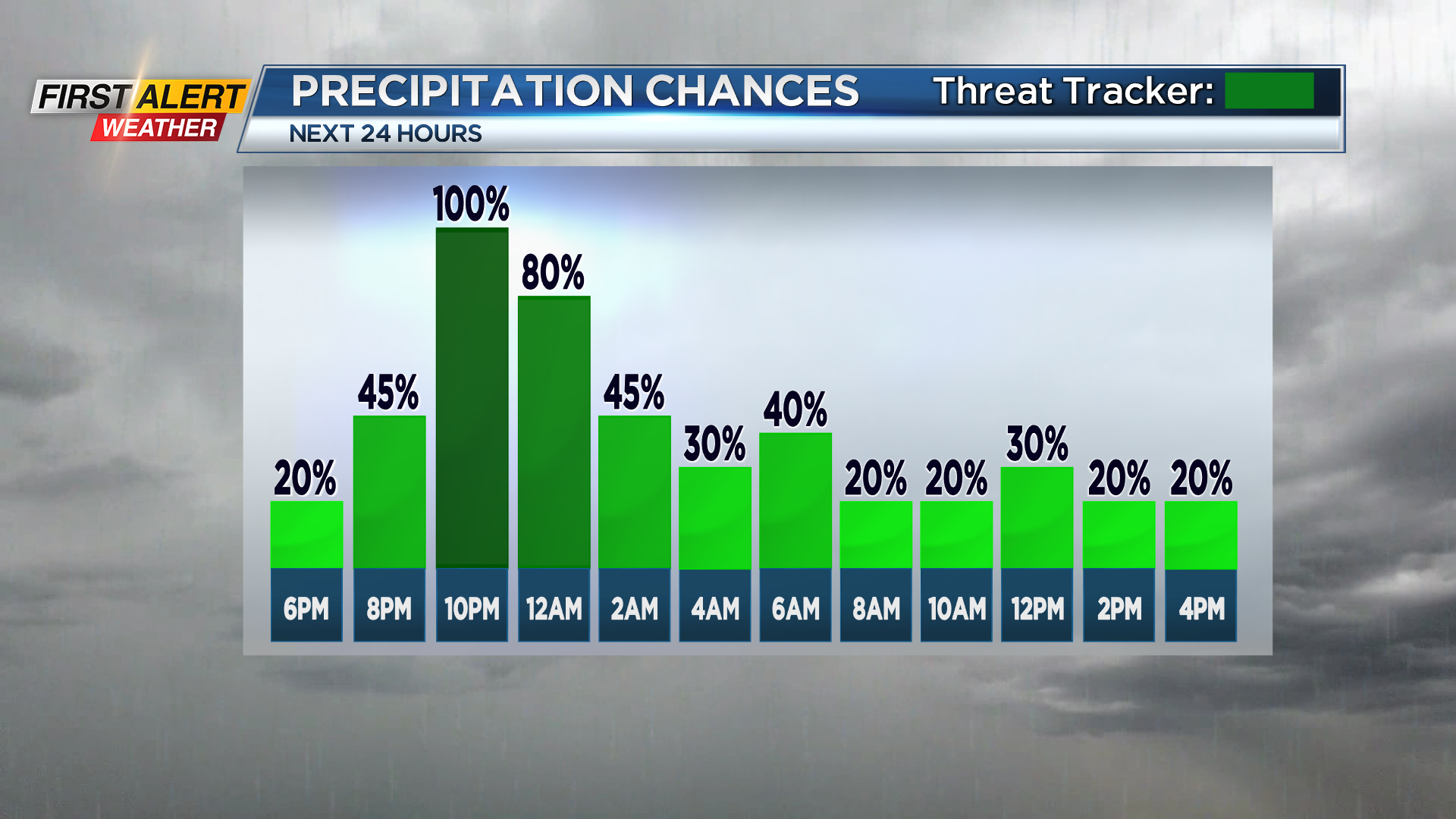
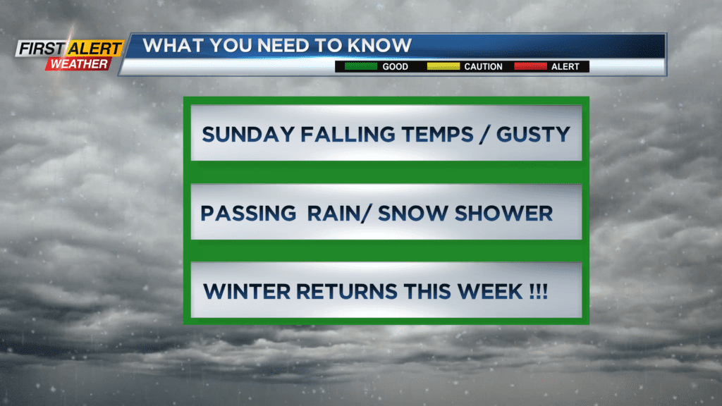
The luck of the Irish was with us for the weather Saturday during the St. Patrick’s Day Parade. However, this will change rapidly Saturday evening as a well-defined cold front will cross the area and bring a period of persistent, chilly rain showers. This will be one of several waves of colder air heading for Rochester during the upcoming week. As a result, Western New York will find much colder weather with periodic snow showers. Winter will hold on even though the spring season officially arrives on the calendar on Tuesday.
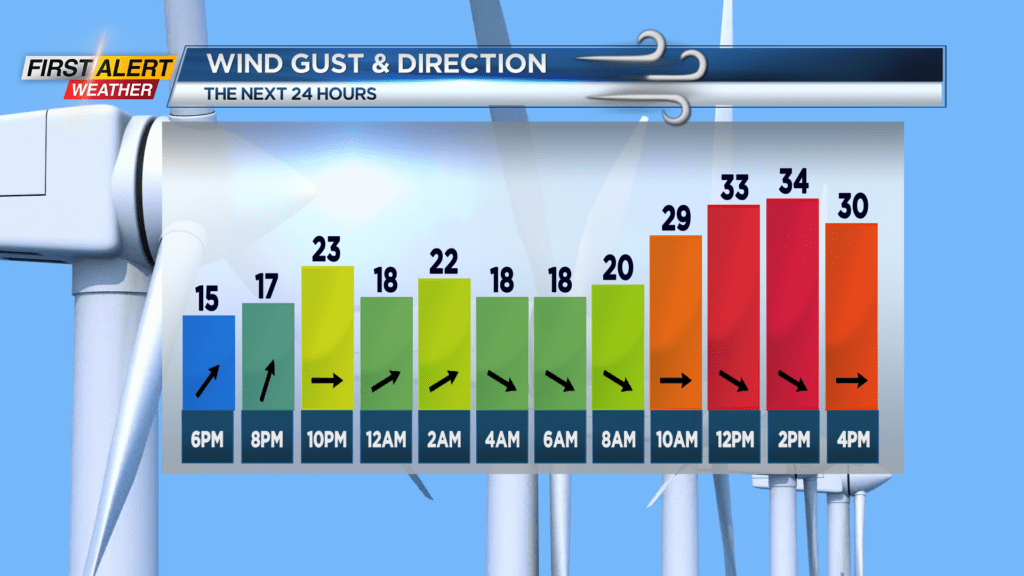
Saturday night, look for occasional rain, which will taper to showers later in the night. It will turn chilly as the temperature falls into the upper 30s later Saturday night. St. Patrick’s Day will bring changeable weather for morning into the afternoon. We could see everything from a few sunny breaks, a passing rain, or a wet snow shower. By the end of the day, we could even mix in some graupel from time to time. It will be blustery with the temperature falling though the 40s.
As mentioned, winter-like weather is here for much of this upcoming week. Monday appears to be mainly gray skies with passing snow showers and a gusty wind. The temperature will only rise into the upper 30s. Tuesday, the Vernal Equinox (spring season) officially arrives at 11:06 p.m. But there will be nothing spring-like about our weather. More snow showers are likely, and with a gusty wind the temperature will remain in the middle 30s. At this point, the News 10NBC First Alert Threat Tracker will stay green as it appears that any accumulation of snow will be in small amounts and mainly during the overnight hours.
Stay tuned to News 10NBC First Alert weather for updates on the forecast.