First Alert Weather: Wet, and at times white, week ahead
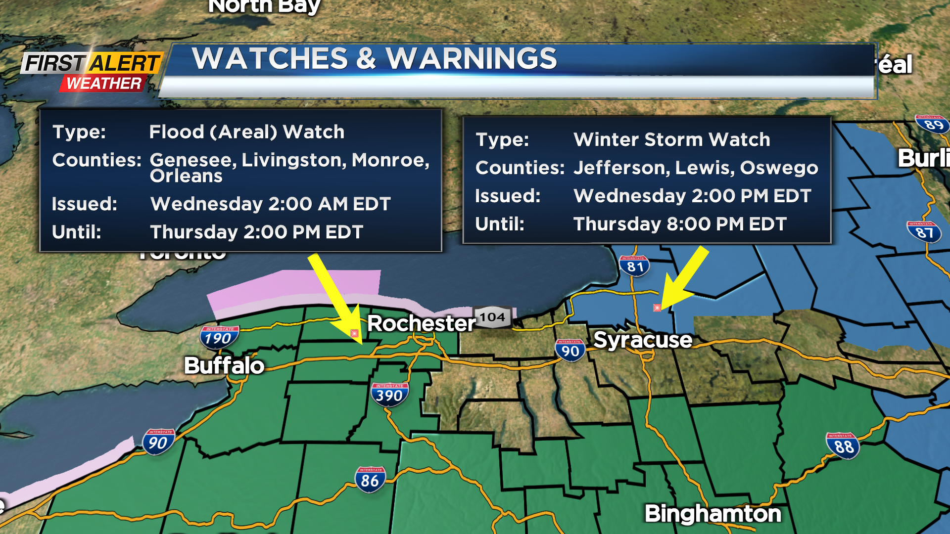
A large and impressive storm system bringing severe weather to the south and Ohio Valley will bring us a soaking rain at times, and eventually some snow. Some rain will begin to fill back in overnight Tuesday night, followed by pockets of heavier rain Wednesday, especially during the afternoon and evening. The main area of low pressure will move just off the East Coast, then stall out. This will throw moisture back into the Northeast through the end of the weekend. We’ll see some of that rain mixing with wet snow starting Wednesday night, but the main accumulation will be focused in the hilltops south of Rochester, with several inches of heavy snow in the highest terrain. Meanwhile, interior New England and the Tug Hill (again, highest terrain) will be seeing a full-on late winter/early spring snow storm. We may see some localized flooding issues on Wednesday afternoon and evening, but other than that, our biggest issues will be just miserable weather.
We’ll slowly start to clear the system out by Saturday, with precipitation coming to an end, and sun returning by Sunday. The timing still looks good for the total solar eclipse on Monday, as far as quiet weather goes. We DO expect some mid and high clouds, so the sky likely won’t be perfectly clear, but at this point, we’re still looking “ok” for visibility. As far as temperatures go, we’ll be cooler than average in the 40s this week, 50s this weekend and into early next week, then a nice warm-up, likely into the 60s next week.


