First Alert Weather: Yellow Alert Day brings gusty winds Saturday, lake snow Sunday

ROCHESTER, N.Y. — A Yellow Alert remains in effect for our region through the day on Saturday as we continue to have the threat for strong gusty winds that could knock power out to some.
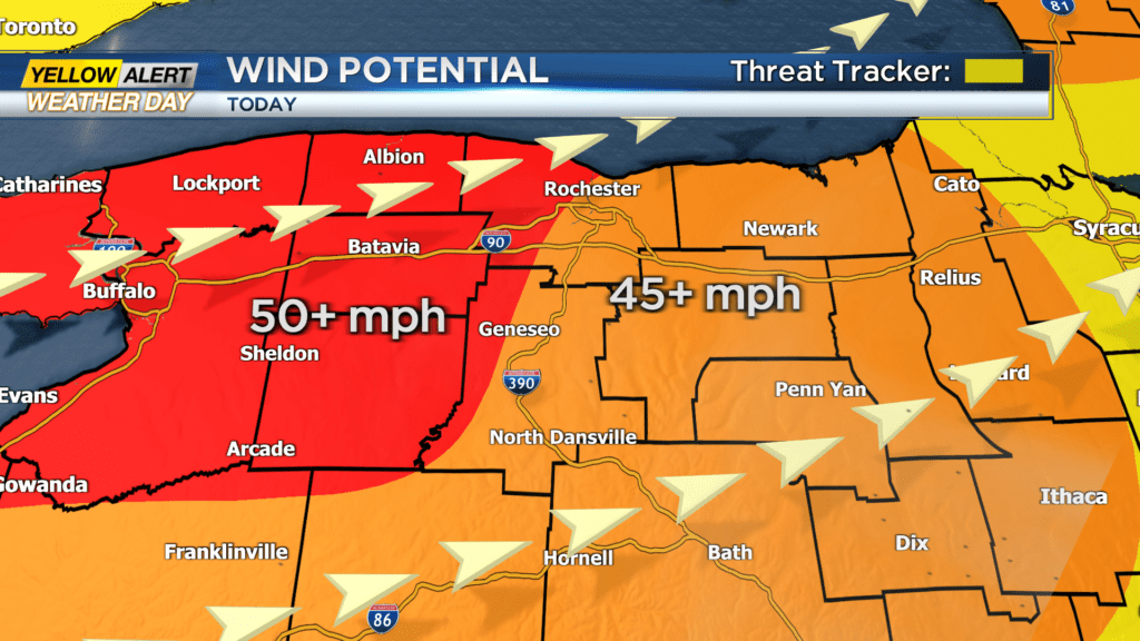
A High Wind Warning is in effect for our region through Saturday, except for Seneca and Yates counties as they are under a Wind Advisory for the day. Winds have been generally quiet thus far Saturday morning but will pick up once a cold front passes by later. This front is expected to pass by around 9 a.m. Saturday and winds will pick up behind it. By the middle of the day on Saturday, we can expect gusts near 40 mph with stronger gusts near 50 mph through the afternoon. Gusts eastward from Rochester will gust between 45 and 50 mph, while areas west of the city will gust between 50 and 55 mph through Saturday evening.
Wind will remain gusty through Saturday night before coming down a bit by Sunday morning. Also on Saturday, the cold front will cool us down. Temperatures Saturday morning are starting off near the 40 degree mark, but will drop to the 30 degree mark in the evening. That, along with the windier weather, will make it feel like the 20s and teens Saturday night. There will also be the chance for a few passing rain showers Saturday morning before transitioning over to snow showers and lake effect snow showers Saturday night.
Lake effect snow will begin to set up Saturday night and get going by Sunday morning.
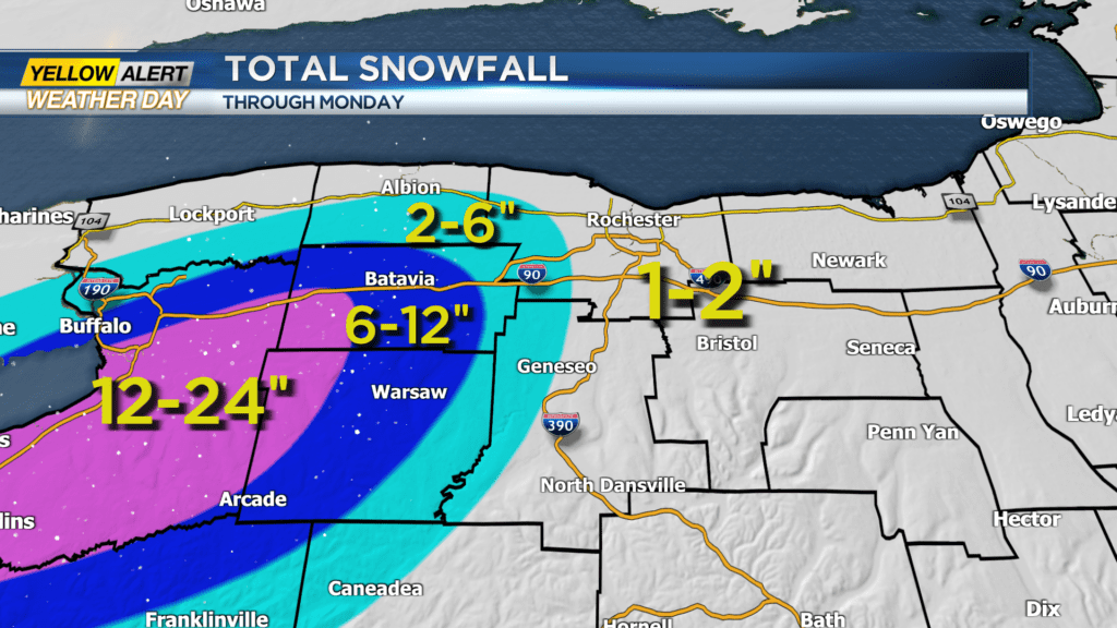
A Winter Storm Warning will go into effect for Orleans, Genesee, and Wyoming Counties for Sunday with heavy lake effect snow possible. A Yellow Alert has not been extended for Sunday as of now, as the heaviest of the lake snow will stay west of Rochester. Lake effect snow will ramp up through Sunday morning and persist through Sunday night before tapering late Monday afternoon.
Lake effect snow will be heavy at times for those west as snowfall rates could reach two to four inches per hour. Most of our region will only see about an inch or so of accumulation, but areas west of Rochester will see much more. Genesee and Wyoming Counties could see between six and 12 inches of snow by the events end Monday evening. Areas just east of there will see a little lest with only two to six inches of snow expected.
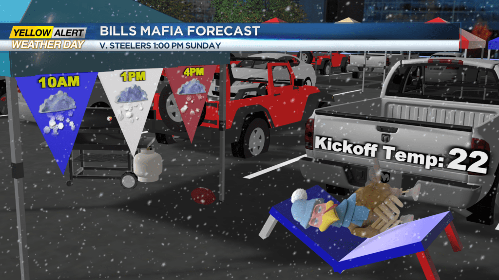
As for Orchard Park and those heading to the Bills game, be careful. Snowfall through Sunday will limit visibility to less than a tenth of a mile and near zero at times. Snow accumulations just for the day on Sunday for that area could exceed a foot with up to two or more feet by the events end Monday. Blizzard conditions will be possible at times in that region too, as winds remain gusty. Not only that, but it will feel much colder too.
Wind chills will be in the single digits and near zero Sunday afternoon, so make sure you bundle up!