First Alert Forecast: An unusually cold weather pattern producing late season lake effect snow
[anvplayer video=”5168414″ station=”998131″]
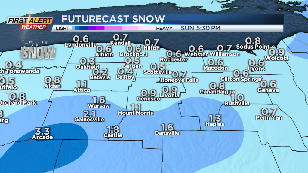
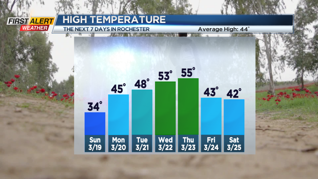
ROCHESTER, N.Y. – Progressively colder weather is moving into the great lakes this weekend. As a result, a late season lake effect snow event has developed off Lake Erie that will continue off and on for the next 12 hours. This lake snow will become better organized on Saturday night under a predominantly westerly wind, which means that communities southwest of Rochester, mainly in Wyoming County, will see measurable snowfall. However, conditions will moderate with the lake snow coming to an end Sunday afternoon. Eventually warmer weather will arrive later in the week as the winds shift more to the southwest by Monday and Tuesday.
Tonight, we will see passing flurries and snow showers. Most areas will see no more than a dusting of snow, but portions of Wyoming County will see between one to four inches for the overnight. Everybody will feel the windy and cold weather as the temperature pushes into the lower 20s. Sunday any passing flurries and snow showers will taper and come to an end for the afternoon. Most communities should see less than an inch of new snowfall. Skies may brighten for the afternoon. Again, it will be windy and unseasonably cold. with the temperature only reaching the low to middle 30s. Monday the official start of the spring season arrives with the vernal equinox scheduled for 5:24 p.m. This is appropriate as milder temperatures will make a return to Western New York. Monday looks mostly sunny skies with a high temperature in the middle 40s, and it will likely get even warmer by Tuesday as the temperature nudges to 50 degrees.